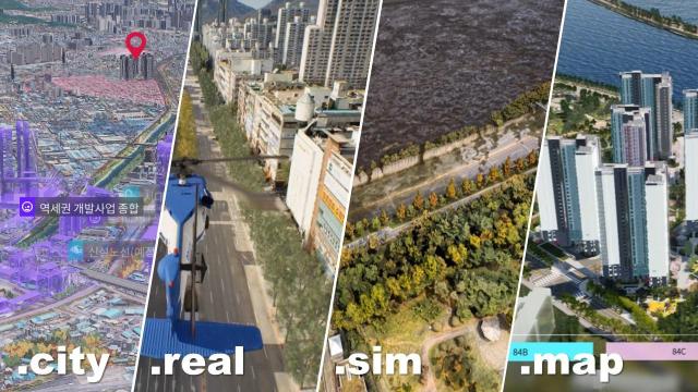
SEOUL -- South Korea's urban air mobility aircraft maker Voltline has adopted "Around," a three-dimensional spatial information platform created by Techtree Innovation, a domestic company specializing in geospatial visualization technology. Using Techtree's ultra-precision map platform, Voltline will develop a simulator to test the functions of flying passenger vehicles in virtual space.
Urban air mobility (UAM) is a future ecosystem involving flying passenger vehicles in city areas. Aerial vehicles are required to fly through designated aerial corridors to prevent accidents and improve the safety of pedestrians on the land. Vertiports will be placed on safe places like rooftops.
South Korea's transport ministry launched a public-private consultative body in 2020 to commercialize manned drone taxis in 2025. Remote-controlled vehicles will be adopted in 2030 and a fully autonomous service in 2035.
"We provided 'around' to Voltline to help the company gather 3D geospatial data for its UAM simulator," Techtree's communications manager Simon Moon told Aju Korea Daily on January 19. Moon added the simulator could be utilized for UAM pilot training.
Unlike many other companies and government organizations that rely on light imaging detection and ranging (LiDAR) sensors to establish digital maps, Around was developed using aerial photographs captured by drones. Because the platform serves as testing grounds for novel technologies, Around could be used for other areas such as smart city construction, autonomous driving, aviation, military training, and disaster prediction.
reporter

Kim Joo-heon
jhkim123@ajunews.com
Copyright ⓒ Aju Press All rights reserved.