
For Seoul, the rude awakening came after South Korea and the UNC concluded that North Korean mines planted about 10 meters south of the MDL caused last month’s explosions that injured three South Korean soldiers.
GPS measurements placed both blast sites and another North Korean resin-bodied antipersonnel mine discovered nearby south of the line, according to the South Korean military. Investigators concluded that the mines had been deliberately buried in violation of the Korean Armistice Agreement.
The boundary itself has not changed. The maps, coordinates and surviving markers used to identify it, however, do not always align.
“The MDL applied by our military has not changed,” a Joint Chiefs of Staff official said, while acknowledging differences in how the line is located on the ground.
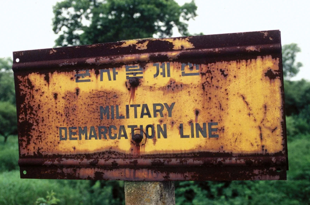
Some surviving markers sit slightly north or south of the boundary shown on modern military maps, officials said. South Korea’s military also cannot establish precisely which reference North Korea uses.
The problem traces back to the Korean Armistice Agreement signed on July 27, 1953. The agreement fixed the MDL on an attached military map, roughly following the final line of contact between opposing forces. Both sides were required to withdraw 2 kilometers, creating the approximately 4-kilometer-wide Demilitarized Zone.
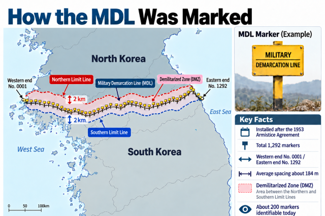
Locating the boundary now requires translating references from 1950s maps and physical markers into modern digital coordinates.
South Korea uses an MDL represented on military maps established with the U.S. National Geospatial-Intelligence Agency in 2004. The UNC generated a separate set of coordinates through its “MDL Project” in 2016.
The two references are close but do not overlap perfectly everywhere. South Korean officials believe North Korea may rely on surviving markers and other reference points for its own operational understanding of the boundary.
The Defense Ministry described the issue Tuesday as “complex,” saying military operations must account for the South Korean and UNC references as well as Pyongyang’s possible interpretation.
The risks have grown as North Korea expands fencing, minefields, roads and other fortifications near the line.
North Korean troops crossed south of the MDL more than 50 times this year while conducting border work, compared with nine cases in 2024 and 17 last year, according to the JCS. South Korean troops have repeatedly responded with warnings and warning shots.
Seoul proposed inter-Korean military talks in November 2025 to clarify the boundary amid concerns that differing interpretations could trigger an accidental clash. Pyongyang did not respond.
South Korea and the UNC have also been working through a joint task force to reconcile their references, the ministry said.
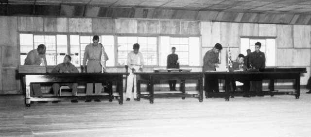
The command consequently remains closely involved in armistice matters inside the DMZ, including the MDL. Its formal authority, however, does not guarantee North Korean cooperation.
Reaching a common understanding would require more than replacing missing signs, said Im Seong-jae, a visiting researcher at Dongguk University’s Institute for North Korean Studies. The parties would need to agree on how the original boundary translates into modern coordinates and applies on the ground.
“North Korea is unlikely to respond to a proposal to sit down and redraw or resurvey the MDL,” Im said.
Without agreement, differing perceptions could continue to create risks inside the DMZ, he added.
For Seoul, the immediate options include removing North Korean mines confirmed south of the line, warning against further violations and monitoring activity near the boundary. Resolving the underlying discrepancy would ultimately require Pyongyang to join talks.
The task is to establish a shared reference for an existing boundary. Until the parties agree on where it runs, a difference of only a few meters can carry military consequences.

Copyright ⓒ Aju Press All rights reserved.