

The Ministry of Land, Infrastructure and Transport said an interagency committee comprising government officials and civilian experts reviewed Google's compliance with security conditions attached to the export of 1:5,000-scale digital maps.
Google applied for permission in February 2025, and the government granted conditional approval on Feb. 27 this year, requiring restrictions on geographic coordinates, security processing of satellite imagery, domestic data processing and emergency response measures.
Google submitted its final compliance report on Nov. 4.
According to the ministry, Google has removed or restricted the display of latitude and longitude coordinates for South Korean territory across its global Google Maps and Google Earth services.
The company also developed a dedicated control system to prevent sensitive coordinates from being exposed through future application updates.
While Google Maps and Google Earth are mapping and geographic exploration services, satellite imagery refers to the images used by those platforms to display the Earth's surface. The government's security requirements therefore cover both geographic coordinate displays and the visibility of sensitive military facilities in satellite imagery.
For satellite imagery, Google signed an agreement on Aug. 31 with a South Korean partner to obtain imagery processed by the National Geographic Information Institute to conceal sensitive military and security facilities.
The domestic partner was identified as TMAP, although details of the agreement have not been disclosed.
The company has also removed Street View images showing the interiors of identified military facilities and roads within 50 meters of their boundaries. Additional restrictions will apply when the domestic imagery is introduced.
Google has also designated the head of Google Korea as its domestic mapping security officer and established a round-the-clock response system.
Under the arrangement, security incidents raised by the government must be addressed within one business day. Emergency measures will also be available during major natural disasters or national security crises.
Officials said the measures would help reduce national security risks associated with Google Maps and Google Earth while allowing the company to expand its use of South Korean geographic information.
"We thank the Korean government for recognizing the value Google Maps provides to residents, visitors and local authorities," a Google spokesperson said.
"Having met the Ministry of Land, Infrastructure and Transport's requirements, we look forward to launching Google Maps in Korea," the spokesperson added.

Kim Hee-su
Kim Hee-su is a bilingual reporter at AJU Press, covering defense and foreign affairs. Before joining AJP in 2025, she worked at The Korea Times, where she wrote interview stories, including a profile of North Korean defector Kim Gum-hyok, and produced digital content. She also previously worked as a researcher for KBS News 9’s International News Department, supporting correspondents in 10 countries around the world. She graduated from the University of Toronto in Canada with a double major in Book and Media Studies and East Asian Studies.
Copyright ⓒ Aju Press All rights reserved.
Related News
-
 Naver's map service sees surge among foreign travelers, outpacing Google Maps
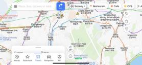
This grab from Naver's map service shows transportation information in central Seoul in English. SEOUL, September 2 (AJP) - Usage of Naver's map service has increased significantly among foreign travelers. The number of daily active users of the service in foreign languages rose by approximately 30.8 percent to an estimated 6.89 million last month, compared to the same period last year, Korea's largest portal said on Sunday. A survey of about 1,200 foreign travelers to Korea, jointly conducted by the Ministry of Culture, Sports and Tourism and the Korea Tourism Organization (KTO) earlier this year, also showed that about 56.2 percent used Naver's map service for transportations and navigation information. The figure surpasses that of Google Maps, which was 33.9 percent. When asked which app was most satisfying during their stay in Korea, 27.8 percent of respondents chose Naver, followed by Papago at 9.9 percent and Google Maps at 6.3 percent. They praised Naver for providing various types of information within a single app (54.2 percent), its user-friendly interface (52 percent), and its support for multiple languages (43.4 percent). Respondents were allowed to give multiple answers. According to the KTO, the number of foreign visitors to Korea during the first seven months of this year stood at 9.11 million, a nearly 70 percent increase from the same period last year. Naver's map service, available in multiple languages including Chinese, English, and Japanese since 2018, enables foreign users to easily access various information and its coverage has recently been further expanded. "We will improve the app with additional features by the second half of this year to make it even more convenient for foreign users," said a Naver staffer.
-
 Apple to compete with Google maps
Apple has unveiled its latest mobile operating system, iOS6, at its annual Worldwide Developers Conference. The operating system, which runs on its iPhone, iPad and iPod Touch devices, will no longer include Google Maps software.Apple will instead run its own mapping app, which has a high-quality 3D mode, on the platform. Google announced its own 3D mapping software last week on its competing mobile platform, Android. Both companies have used fleets of planes to capture the imagery, drawing concerns from some privacy campaigners.Apple‘s updated iOS software is being released in beta on Tuesday, and will be available for general consumers by the autumn, chief executive Tim Cook said. It will be a free update for owners of either an iPhone 4S, iPhone 4 or iPhone 3GS - as well as users of the latest iPad, the iPad 2 and fourth generation iPod touch.Additional features include “eyes free” a feature on which Apple said it had worked with car manufacturers to integrate a “Siri button” to activate the iPhone’s voice-operated assistant.For the first time on Apple‘s devices, video calls will be able to be made over a cellular connection, rather than relying on wifi. The switch to its own mapping platform will provide Apple with even more opportunities to monetize its users, said Carolina Milanesi, an analyst for Gartner, who attended the event in San Francisco.아주경제 앤드류 이 기자=
-
 Google Maps enables ‘offline mode’
"Google Maps" is available in both Android and iOS “Google Maps”, an application by Google, now supports offline mode. Now its users will be able to use it anywhere – even when they cannot get connected to internet, Google said on Wednesday. The app, pre-installed in Android smartphones, is one of the most used apps in the world. Smartphone users use the app when searching for how to get to places, looking for a store nearby, navigate on the move. But the app had a major problem. It was not usable without an internet connection. As Google stated in its official blog, about 60 percent of the world is without internet. When travelling overseas without local data sim card or out in rural areas where there’s no mobile data coverage, it was impossible to use the app. Google solved the problem by enabling the offline mode. According to Google, Google Maps users can download an area of the world to their smartphone and even without any internet connection, the app will work seamlessly. Navigation, finding places, and all other features will work based on downloaded data. Map data can be downloaded by searching for a city or a country by simply tapping a few buttons. After that, the app will move into offline mode automatically whenever it can’t get connected to the web. 아주경제 박세진 기자 = swatchsjp@ajunews.com